Better Soil Maps Needed to Map Plant Species Distributions in Amazonia
An international research team has shown that the modelling of species distributions in Amazonia requires information not only of climate but also of soils. At the same time, they found considerable inaccuracies and other problems in the available soil maps. For conservation planning, it is important to obtain reliable information on where and how widely different species are distributed in Amazonia.
An international team including researchers from the University of Turku, Finland, showed that soil maps are important when modelling distributions of Amazonian plant species. Without soil information, the area of suitable habitat was often overestimated.
The researchers also evaluated the available soil maps and found that these contain considerable inaccuracies. Missing or erroneous soil data can lead to dangerous mistakes in conservation planning, where species distribution maps help in selecting priority areas.
Species distribution models are used to predict where species are likely to occur. Traditionally, such models are based on the idea that the range of a species is mostly controlled by climate.
– We thought that this sounded too simplistic. Our earlier studies have suggested that soils are very important determinants of plant distributions in Amazonia, says Hanna Tuomisto, who leads the Amazon Research Team at the University of Turku.
– Researchers may have overlooked soils when modelling species distributions partly because broad-scale climatic data have been more readily available than soil data, says Gabriel Moulatlet from the University of Turku.
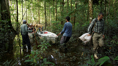
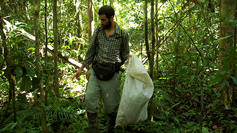
Transport in Amazonia happens often over water. During the annual floods, it is possible to enter deep into the forest by boat.
Moulatlet led the study that evaluated how reliable the recently published digital soil maps are.
– We discovered big problems in the soil maps and that they also lack the soil properties that are ecologically most relevant, Moulatlet says.
Another study led by Fernando Figueiredo from the Brazilian National Institute of Amazonian Research tested which combinations of climatic and soil data best predicted the occurrences of Amazonian plant species.
– The differences were very large and the maps including soil data were almost always the most accurate ones, says Figueiredo.
– Importantly, all plant groups included in the study gave similar results — gingers, ferns, palms, lianas and trees. This indicates that the results are valid for plants in general, Tuomisto adds.
Climate change scenarios suggest that Amazonia is becoming drier, so the area that is climatically suitable for rainforest plants might be becoming smaller. If the ranges of the species are also strongly limited by soil properties, it will be more difficult for species to find and track sites where all environmental conditions are suitable for them. These findings have a large impact on the predictions for the future of Amazonian plants.
– Conservation planning needs species distribution models that take into account both climatic and edaphic suitability. However, much of Amazonia is still so poorly known that producing reliable models is challenging, says Gabriela Zuquim from the University of Turku who participated in the studies.
>> Read the research articles: https://doi.org/10.1002/ece3.3242 and https://doi.org/10.1111/jbi.13104
MR
Photos: Hanna Tuomisto