Geospatial Collaboration Supports Business Development in Tanzania
Tanzania offers Finnish geospatial companies a possibility to become international and to create new services. At the same time, the companies take sustainable business to Tanzania and support the development of local business culture. The University of Turku is involved in the project that aims to develop new business solutions related to geospatial and ICT technologies for the markets of developing countries.

Individual companies have a major role in the Finnish development co-operation, and the aim is to create wealth and well-being in developing countries with entrepreneurship. A shared project of the Department of Geography and the Department of Information Technology at the University of Turku pursues the same goal. The project supports the transfer of Finnish geospatial companies to the Tanzanian market with research and local co-operation.
– Exporting sustainable business to a target country is the best kind of development co-operation, as it develops the society permanently. At the same time, companies get to create new services to answer direct needs and with small resources, in which case solutions are made extremely simply and with as little money as possible. This may create innovations that can be later exported to western markets, says University Teacher in software engineering Antero Järvi.
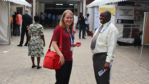
Together with the University of Dar es Salaam (UDSM) and local geospatial operators, the leaders of the project organised the Tanzania Geospatial Expo in the biggest city in Tanzania, Dar es Salaam, on 16–17 November 2016. The event explored the possibilities of geospatial business. Two Finnish geospatial companies were involved: Arbonaut and Vionice. Minister of Foreign Trade and Development Kai Mykkänen gave the opening speech and the event was sponsored by the University of Turku, Ministry for Foreign Affairs of Finland and the World Bank.
– Exporting business to Tanzania is important as the public administration is not agile, dynamic and accomplished enough to advance, for example, sustainable development and human rights. The companies can address the problems and consider how technology and local expertise could help, notes University Lecturer in geography Niina Käyhkö.
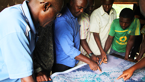
The geographers from the University of Turku have worked with geospatial research, teaching and development co-operation projects in Tanzania already for 13 years. Now the locals start to have geospatial expertise, but the business sector is still missing. The researchers hope that with the export of business, Tanzanians themselves would start developing innovations that would improve the quality of life for people.
– Geospatial data is linked to almost everything in a society. Services can be made more effective with geospatial data, when the locations of the services and their target audiences are known. New innovations could be related to, for example, improving everyday mobility, so that people could avoid getting stuck in traffic for five hours, suggests Käyhkö.
The Geospatial business ecosystem in Tanzania (GESEC) is a two-year project of the University of Turku, three Finnish geospatial companies (Arbonaut, Dimenteq, Vionice) and their Tanzanian partners in co-operation. It is funded by the BEAM programme of Tekes.
As part of the project, researchers are studying how the expertise and business solutions of Finnish technology-led companies are refined for the needs of developing markets, and how the operator network develops and changes along with interaction. The project also examines how digital geospatial solutions support participation and create possibilities for better decision making based on location in the society, as well as what benefits the geospatial solutions bring to Tanzanians.

University Lecturer Niina Käyhkö has been working with projects related to Tanzanian geospatial expertise for already 13 years.

More information:
Translation: Saara Yli-Kauhaluoma